Location
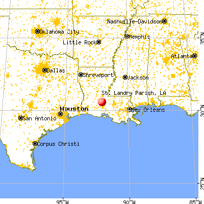
Where is St. Landry Parish?
Centrally located in Southwest Louisiana, St. Landry Parish sits at the crossroads of State Highway 190 West and Interstate 49 North/South. St. Landry Parish's location is among one of its features. Additional arteries winding through the area include U.S. Highway 167 and 190 and State Highways 31, 182, 357, and 749.
The Parish is 939 square miles in area, and is bordered by the Parishes of Avoyelles, Point Coupee, St. Martin, Lafayette, Acadia and Evangeline. There are 12 municipalities located within the Parish.
St. Landry Parish offers seasonable climates and one-day access to other major cities.
Distance to Other U.S. Major Cities
| City | Miles to Opelousas |
|---|---|
| Lafayette, LA | 20 |
| Baton Rouge, LA | 55 |
| Alexandria, LA | 65 |
| New Orleans, LA | 150 |
| Shreveport, LA | 190 |
| Natchez, MS | 140 |
| Jackson, MS | 230 |
| Houston, TX | 235 |
| Mobile. AL | 260 |
| Dallas, TX | 370 |
Strategic Location
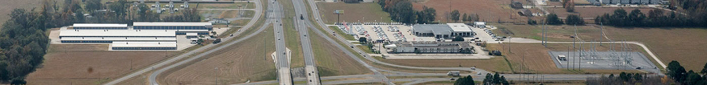
 St. Landry Parish has assets for the attraction of ware-house - distribution centers. Its location to Interstate - 10 and Interstate - 49 along with U.S. Highways 190 and 167, provide north-south and east - west connectivity to north Louisiana and Texas and on into numerous Southern state
The Wal-Mart Distribution Center in St. Landry Parish provides an opportunity to feed products into Wal-Mart's distribution network, which is a location advantage for warehousing by Wal-Mart national and regional vendors. It is also an advantage for manufacturers that are Wal-Mart vendors.
In addition, the two general airports and a shallow port with barge and deck access on the Atchafalaya River make the parish attractive for this industry.